About Five Main Uses of GPS, It is highly likely that all your devices right now apply some uses of GPS. Whether general tracking or navigation, GPS technology has made your life easier.
GPS satellites stay active to give accurate readings for industries such as mining, construction, aviation, agriculture, and logistics.
On a more practical level, you use GPS to track your location hail cabs, plan your work routes, and access phone apps.
Besides military use, we’ll find out how GPS applies in everyday functions that make life more convenient.
What Are The 5 Main Uses For GPS?
We experience the use of GPS technology every day. However, we can chalk them down to five main categories. Every practical application falls into one of a few of these categories.
Location
GPS’s core use is location precision. You might go as far as making location the main service of GPS.
GPS satellites can pick out your location with only about 10 meters off the exact spot.
Navigation
After location, GPS is incredibly vital for navigation. It provides the basis for moving between locations.
Tracking
GPS tracking is critical for trade all over the world. Entire industries depend on precise GPS-enabled monitoring of either people or goods.
Mapping
GPS is constantly used to update area and global maps. In the larger picture, accurate mapping puts businesses and new transport routes on the map.
Timing
Every GPS receiver sends and receives signals from GPS satellites. These satellites have atomic clocks that provide time data for precision accuracy. The GPS receivers synchronize their timing according to these atomic clocks to get precise time.
What Is The Main Application Of GPS?
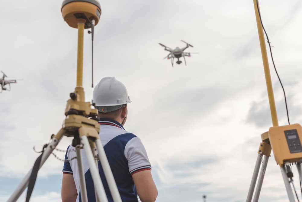
Drone surveying on location with a GPS device in the frame
You can sum up the main applications of GPS as providing precise locations and exact timing. Every application using GPS for core functionality relies on these metrics to ensure it runs smoothly and provides users with authentic results.
The utility of GPS in location accuracy is limitless. It’s clear in operations such as food and package delivery.
Location data is stored over time and used to make new routes that improve transport networks and ease congestion in cities and waterways.
Critical services like emergency operations rely on time and location to be successful.
Of course, these are general uses for GPS. But did you know there are everyday uses of GPS?
Uses Of GPS In Everyday Life
Cab Hailing and Service Delivery
How many times do you order a cab every day? Years back, you would have to stand on the curb and thumb down a taxi.
Then you’d have to haggle over the price to get you from A to B.
Now, you’ll get on your phone, pick your preferred cab app, and hail the nearest ride. Thanks to GPS technology, these apps even show you the rate, depending on estimated time and distance.
Also, please think of how convenient it has become for you to get things delivered to you. Whether it’s food, stuff on discount sales, or stuff in another state, GPS is the backbone behind successful last-mile delivery operations.
GPS enables these companies to manage their fleets and plan new delivery routes.
Driving
Modern cars come loaded with GPS. The GPS technology in cars is so advanced that it helps in autonomy, the juice behind self-driving cars. GPS takes over following a pre-set route that can get you to destinations you might not know.
Also, you can use your car’s GPS to pick the shortest route and reduce travel time.
Recovery and Security

GPS locator for pets
Crime is a constant looming concern in many cities worldwide. We lose phones, laptops, cars, and even pets.
However, most electronic devices have GPS capabilities. When you lose your devices, you report the incident at any law-enforcement location.
The authorities use GPS tracking to trace and recover the stolen merchandise.
Such activities are logged into a system that maps out notorious areas.
This data goes to a planning committee that then allocates resources to make such areas safer for the public.
Finally, the area ends up on a GPS map as a safe area for family-friendly facilities.
The Financial Market
Every day you get up, key services behind the scenes affect your daily life.
For example, the financial markets use GPS to keep timing details and synchronize time in digital clocks.
These accurate time details help keep a close eye on global financial markets to track exchange rates and global trading.
Also, companies with integrated financial systems use GPS to track precise timing details of financial transactions.
It makes it possible to track paper trails, conduct audits, and curb fraud.
Finding New Locations

Man uses GPS in a forest
GPS can be extremely helpful if you are new to a place and struggling to scope familiar places to hang out, shop, eat, or even go to school.
GPS helps you find nearby places to reduce time and wandering costs. And here’s where it gets better. Places on GPS maps usually have user reviews and ratings.
Therefore, you can use the reviews to pick out the best places for what you need.
Uses of GPS Technology In Disaster Management
Erratic weather patterns sometimes carry disastrous outcomes. However, GPS has been incredibly helpful in preparing for disaster, carrying out life-saving operations, and ensuring similar incidents don’t have similar results when they happen again.
Forecasting
Civilian GPS receivers are great at calculating their positions, so much so that phones can calculate location down to a few meters.
However, scientific GPS receivers are more precise, down to a few millimeters.
This technology helps them detect ground movement before moving closer to the surface.
Scientists switch from seismic readers to GPS devices to map out disasters such as earthquakes that usually begin with ground movements.
The scientists assess when disaster will strike and tally the potential damage.
They issue warnings to reduce human fatalities.
A great example of late detection is the 2004 Sumatra earthquake. The earthquake would have had less than 280,000 casualties if GPS had been used to give early warning.
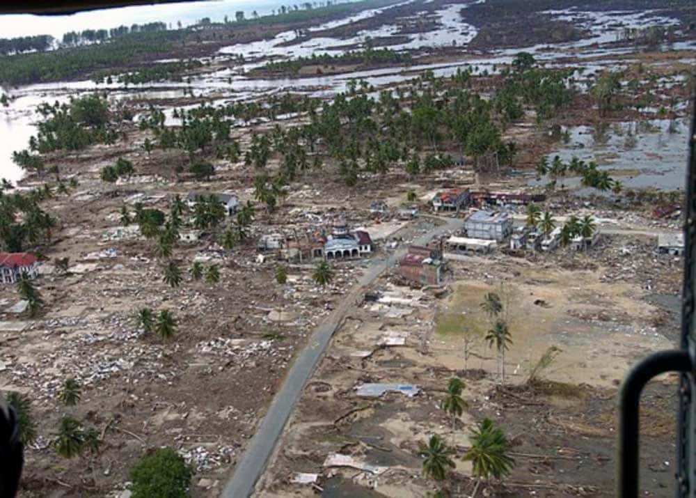
Aftermath of the 2004 Sumatra tsunami
Search and Rescue
Besides normal emergency operations, GPS is necessary during search and rescue in inaccessible areas.
GPS combines time and location information during a disaster to map out heavily affected areas, reducing the time it takes to rescue casualties.
Also, it comes in handy in places like mountains where it isn’t easy to signal for help. The responders can then use satellite phones to get assistance faster to reduce fatalities.
Preventing Future Accidents
The growing global population means airspaces and waterways are getting more congested.
Therefore, timing must be more precise to make air and maritime transport more efficient.
Aviation and maritime authorities develop positioning and routing systems to manage air and water traffic.
Routing experts use advanced GPS systems to reduce the possibilities of airborne and maritime traffic collisions.
How is GPS Used in Surveying?
GPS-enabled surveying is used to find new water bodies, reclaim damaged marine areas, and map out mining hotspots.
Each activity above uses different technology. However, GPS is the common factor in locating prime spots for all of them.
Coastal surveying, water body discovery, and waterway monitoring help scientists detect the effects of oncoming droughts and plan effectively against them.
It takes more effort and advanced GPS machinery to get precise results in water and areas far from land.
GPS in mining helps save lives. The data from mining surveys is a vital piece in environmental impact evaluation.
Experts can figure out the risks of mining in a location. The data maps an area and assigns autonomous vehicles to mine the surveyed area.
Conclusion
The GPS applications we have covered are only a small chunk of the limits of the technology.
We haven’t fully explored the maximum potential of GPS technology. With the new satellites going up, we might witness new and unprecedented uses of GPS.