With the technology being so accessible, how can everyday people use GPS land surveying to improve their lives?
These days, it’s hard to find a mobile smart device that doesn’t have direct access to global positioning and navigation satellite systems.
Depending on where you are, you should be able to connect to the North American Global Position System (GPS) or Global Navigation Satellite System (GNSS).
Your smart devices can use these systems for more than just identifying your current location.
This guide will show you how to effectively use GPS for land surveying.
What is GPS Land Surveying
Land surveying describes measurements and recording data concerning a specific piece of land.
It typically involves using physical markers and recording the distance and angles between them.
Surveying is used in fields and applications such as cartography (map making), architecture, engineering, and property development.
As with any other practice, there are different types of surveying. The two main categories are:
- Geodetic surveying: Considers the curvature of the Earth in its measurement. This form of surveying heavily relies on trigonometry to accurately measure and calculate large distances and areas.
- Plane surveying: Does not take the curvature of the Earth into account when performing measurements and calculations. However, it also uses polygon angles to calculate plane angles. This form of surveying is best for small, flat areas. The greater the distance, the more inaccurate measurements from plane surveying will likely be.
GPS uses a geodetic system to attain its coordinates and make its measurements. To be precise, it uses the World Geodetic System (WGS84) as its reference system.
GPS is particularly suitable for surveying because it can directly obtain the longitude and latitude coordinates.
This eliminates the need to manually measure the distances and angles between fixtures or points.
Albeit, GPS technology hasn’t completely replaced all other modes and methods of surveying.
Surveyors sometimes deploy it with traditional tools and resources to produce a more complete picture.
How Does GPS Surveying Work?
While you can perform simple or preliminary surveying using a GPS-enabled smartphone and compass, professionals use more intricate tools. The receivers they use are far more sophisticated and powerful.
GPS uses a constellation of interconnected satellites that communicate using radio frequencies.
When a receiver initiates a request, at least four satellites respond. Each satellite will send its position concerning the receiver.
The satellite will also send a timestamp and the distance between the receiver and itself.
The receiver or GPS software can then use this data to ascertain the longitude, latitude, and height of the receiver.
There are different GPS surveying techniques. They all more or less rely on the above GPS functionality.
Static GPS Baseline
This method uses two surveying points. The GPS satellites record the distance or position of these points over an established period.
The data is then fed into computer software that calculates and mathematically deduces the distance between these points.
Because of the Earth’s orbit and curvature, distortions in the data can occur. Hence, the static GPS baseline method takes multiple measurements over time to combat inaccuracies.
Incidentally, it has proven accurate with about a 30 mm margin for error.
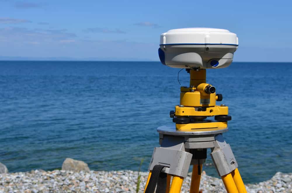
GPS Receiver Base Station
Real-Time Kinematic Observations
Real-Time Kinematic observations are not all that different from static GPS baseline measurements.
Instead of two static receivers, this method uses a single static base station and mobile receiver (rover).
This allows us to measure the distance between the base station and multiple points. We typically perform these measurements in quick succession over long periods.
In real-time, we collect the measurements between the base and rover station for efficiency.
Because we know the exact position of the base station, we can quickly amend or correct any discrepancies in the measurements.
Real-Time Kinematic Observation-based GPS surveying is almost as accurate as baseline measurements. However, it has a 20-kilometer range limit.

Engineer Setting Up a Reciever
Continuously Operating Reference Stations (CORS)
While stationary, Real-Time Kinematic Observation base stations are temporary. Base stations in a CORS system are permanent.
Ultimately, CORS works exactly like the above-mentioned techniques. However, it allows us to measure the fixed-based station anywhere in a district.
Again, the reference receiver should be within a 20-kilometer radius of the base station.
We use CORS in applications such as surveying mining sites, government building projects, establishing wide area network infrastructure and other long-term engineering projects.
Advantages of GPS Surveying
Why use GPS surveying in place of traditional or more established forms?
Flexible and Reliable
Firstly, GPS surveying is reliable and flexible. Both satellite television and the internet have a bad reputation for service interruptions during bad weather.
As such, shouldn’t we worry about GPS facing outages or being non-functional due to visibility issues caused by weather anomalies or other connection-based problems?
GPS satellites can still ascertain their last-known or current positions and determine the distance.
This makes GPS especially ideal for surveying coastal locations and waterways with very little land to use as reference points.
You can also take the measurements remotely using drones as rover stations. This makes GPS surveying safer – at least potentially.

GPS and Drone Land Surveying
Portable
As we previously mentioned, GPS receivers and antennae are extremely mobile. GPS equipment for land surveying isn’t the exception to the rule either. While they’re typically larger, they are still fairly portable.
Like Starlink’s RV package, you can carry most of them in a backpack or mount them on top of a vehicle.
Speed
Land surveying through GPS is substantially faster than older methods. You can retrieve and compare measurements within minutes. This increases the productivity and speed of construction and engineering projects.

Satellite Constellation Orbiting Earth
Disadvantages of GPS Surveying
No technology is perfect. There are downsides and disadvantages to GPS land surveying. For instance….
Requires Clear-Line of Communication
Receivers and base stations require a clear line of communication. Cloudy weather isn’t the only possible impedance, either.
Antennas and stations must be placed in areas free from large trees and a concentration of tall buildings.
Accuracy is Dependant on Equipment and Operators
GPS surveying technology can be extremely accurate when placed in the right hands.
However, low-grade equipment can yield inaccurate results, especially in unskilled or inexperienced hands.
As such, firms and those in charge of the measurement process must utilize well-maintained, top-grade equipment.
Moreover, you must hire people with sufficient experience and expertise.

Engineer Setting Up GPS Receiver
GPS Equipment Can Be Expensive
Top-grade GPS equipment can be costly. Sometimes, managers and firms may try to acquire cheaper alternatives.
Unfortunately, if you want the right expertise along with quality tools, you have to pay for it.
GPS Land Surveying: Conclusion
GPS land surveying will continue to be employed in commercial sites and roadwork for the foreseeable future.
The GPS isn’t the only satellite system you can use for surveying. Galileo may even be more accurate for land surveying than GPS is.
Regardless of which satellite system you use, the benefits are evident. Consequently, we can expect to see this technology improve in the future.