GPS GLONASS Galileo and BeiDou are some of the most well-known navigation systems.
Once upon a time, GPS was the only seemingly available satellite navigation system for consumers. In fact, GPS is essentially synonymous with satellite navigation.
We call wearables and navigation systems GPS watches and GPS trackers (respectively), even though they support and cater to different navigation systems.
Ultimately, you may be using (what we refer to) a GPS watch that uses a different Satellite system (such as GNSS) by default.
But what’s the difference between each system, and which one is the best for you? The following guide will answer these questions and more.
Understanding Global Navigation Systems
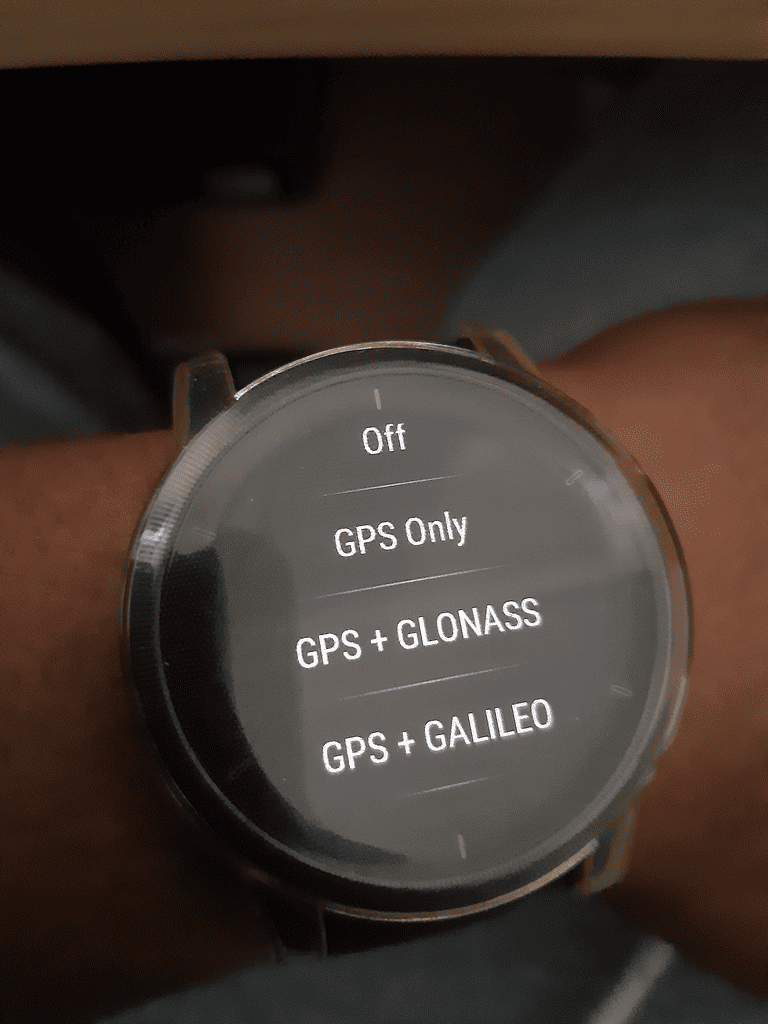
Many GPS-enabled devices allow you to choose alternative satellite navigation (satnav)/tracking systems that aren’t GPS. You can even select different combinations.
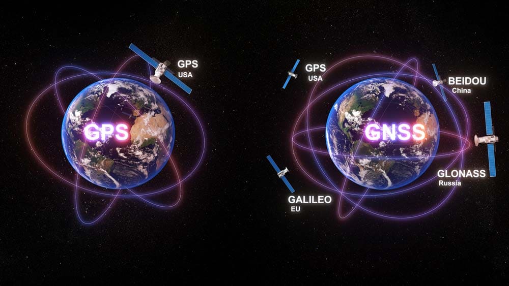
Global civilian satnav systems like GPS fall under the umbrella of Global Navigation Satellite Systems (GNSS). Not all GNSSs are equal. There are currently two classifications:
- GNSS-1: Current first-generation navigation and augmentation satellite systems.
- GNSS-2: Next-generation civilian global satnav systems that will offer more precision and accuracy.
Most GNSSs are gen 1 (GNSS-1) – mostly because they use a single frequency band. However, more manufacturers have begun to roll out dual-band devices.
All GNSSs have three main functions: positioning, navigation and timing.
Some work better than others, mainly because of their coverage and augmentation systems. Ultimately, each GNSS consists of a constellation – much like Starlink.
So let’s look at what separates GPS, GLONASS, Galileo and BeiDou. Let’s look at them all individually first.
GPS: What is It?
GPS watch
The Global Positioning System (GPS) is a North American GNSS developed and run by the United States government. Many consider it to be the first global Satnav system.
When the US government first instituted GPS in 1979, it intended it exclusively for military purposes.
The US Navy would use it as a navigation system. It wasn’t until 1983 that the US government finally allowed it for civilian use.
As of December 2023, the GPS constellation consists of roughly 31 operational satellites (35 in total).
With satellites regularly losing operability and NASA and the US Space Force developing and launching new ones, this number tends to fluctuate.
Nevertheless, the GPS constellation is so well-distributed that people should be able to spot at least four of its satellites regardless of their location.
This makes GPS available in almost every country.
The more satellites in range, the more accurate triangulation and navigation will be.
On average, GPS-capable devices are accurate within a 4.9 meters radius under clear open, unobstructed skies. Incidentally, accuracy is also dependent on not only your location but the device you use.
For instance, GPS coordinates you capture through professional GPS land surveying equipment will likely be more accurate than those of wearables.
GLONASS
Glonass Global Positioning System Red Arrows
In an effort to stay competitive with the United States of America, Russia released its own global satellite navigation system.
They dubbed it Global’naya Navigatsionnaya Sputnikovaya Sistema\Global Navigation Satellite System (GLONASS).
The Russian government (Soviet Union) began development in 1976.
As of December 2023, they’ve launched roughly over 145 satellites since then. Roughly 133 of these satellites were successful.
There are currently 24 operational satellites in the GLONASS constellation.
Some sources estimate that there may be an additional 7 dysfunctional satellites, meaning there are a total of 31 satellites in the constellation.
There have been different versions of GLONASS since its inception. Additionally, the Russian government plans to release new, improved implementations.
All known current versions include:
- GLONASS-KM: Currently in development and research. The Russian Government plans to release it by the year 2025. It is the 5th version of GLONASS.
- GLONASS-K2: The fourth GLONASS version. Russia released it in 2015.
- GLONASS- K1: The third version of GLONASS. It had a 2011 release date.
- GLONASS-M: The second version of GLONASS. Russia released it nearly 20 years after the first in 2003.
- GLONASS: The first version of GLONASS
If you have a modern GNSS device that can access GLONASS, you may have noticed an additional version that your device has labeled “A-GLONASS.”
This isn’t an entirely different version of GLONASS.
Instead, it’s an augmented version that can perform more accurate triangulations thanks to augmentation systems and cell phone infrastructure.
Consequently, A-GLONASS is more accurate and makes features such as turn-by-turn navigation possible.
Galileo
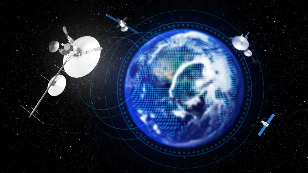
Technology Communication Image Global Navigation Satellite
Galileo is one of the most recent civilian-grade GNSS solutions. Where GPS is a product of the USA and GLONASS of Russia, the European Union (EU) is responsible for the creation and management of Galileo.
However, unlike the aforementioned GNSS constellations, Galileo is not an acronym. Instead, the UN chose to name it after the influential astronomer Galileo Galilei.
Through the European Space Agency (ESA), the UN released Galileo in 2016. After Galileo’s release, the European Agency for the Space Programme (EUSPA) became responsible for operating and managing it.
EUSPA and Galileo have base stations and headquarters all across Europe.
As of the end of 2023, there were 30 total medium earth orbit (MEO) satellites in Galileo’s constellation.
Three of these satellites are backups, while the other 27 are fully operational.
Under clear skies, triangulation is accurate within a 20 CM radius, making it more accurate than GPS.
BeiDou
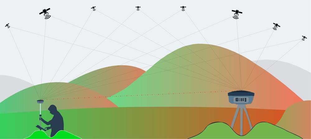
Positioning By Gnss Receiver Tracking Gnss
BeiDou is China’s own satellite navigation system.
BeiDou’s first iteration (BeiDou-1) only offered regional satellite navigation. It consisted of only three satellites.
The project was mostly experimental. The China National Space Administration to further research and development into what would become BeiDou-2.
Nevertheless, the Chinese government decommissioned BeiDou-1 in 2012 and replaced it with BeiDou-2 in the same time frame.
BeiDou-2 (second generation BeiDou AKA COMPASS). As of 2023, BeiDou-2 contains 16 satellites that can provide global coverage.
But it doesn’t end there. BeiDou-3 is the latest generation of BeiDou, which was fully operational by the end of 2016.
It features 30 different satellites in three different orbit types. Twenty-four of these MEO satellites are in MEO; three are in inclined geosynchronous orbits, while the rest (three) are geo-stationary.
Thanks to its use of post-processing and augmentation technology, BeiDou is more accurate than GPS.
However, BeiDou performs better in some regions than others. It’s accurate within a 2.6 m radius in Asia but 3.5 everywhere else.
.
Key Differences Between GPS, GLONASS, Galileo, and BeiDou
Communication Technology Between Gps System Gnss
Those responsible for the creation of GLONASS, Galileo and BeiDou intended it as an alternative to GPS. Creating these systems would allow each country’s citizens to be free from relying chiefly on GPS.
GPS is the oldest satellite system, while BeiDou-3 and Galileo are essentially tied for the newest.
BeiDou’s collection of satellites is more varied than the other three systems. Of its 16 satellites, six are geostationary, another six are inclined geosynchronous and the rest are MEO satellites.
Galileo is the most accurate GNSS globally, while BeiDou is the most accurate in Asia.
GLONASS is not better in performance than GPS. As such, you should consider using it as a backup when you can’t access GPS.
On the other hand, if you can access Galileo, then you should choose it over GLONASS and GPS.
GPS, GLONASS, Galileo, and BeiDou: Conclusion
In the above guide, we explored GPS, GLONASS, Galileo and BeiDou.
Ultimately, the accuracy of each will also depend on the device you’re using and where you are located.
The precision and quality of the GPS signal will also depend on how clear the weather is.
As with Starlink, most satellite constellations may be susceptible to bad weather.
Nevertheless, you should now understand the difference between these global Satnav constellations and have an idea of which one to use.